A new version of the portal to monitor Water Productivity through Open access of Remotely sensed derived data (WaPOR) has become available online.
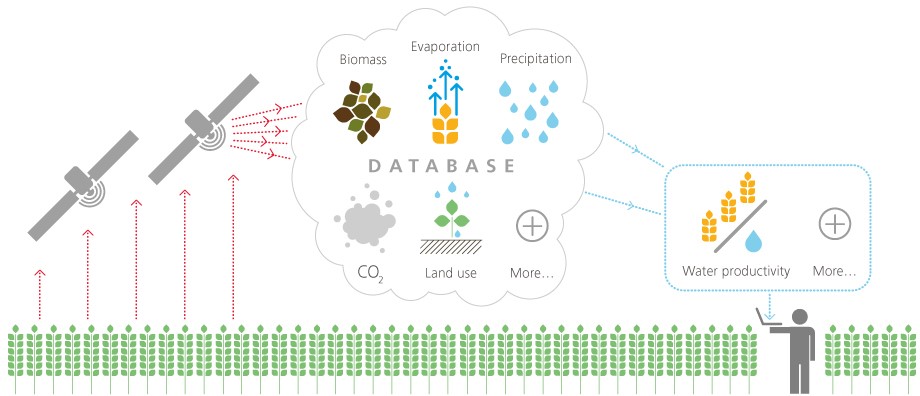
WaPOR is a tool developed by a consortium including Waterwatch for the Food and Agricultural Organisation of the United Nations (FAO). The tool uses satellite data to monitor agricultural land and water productivity throughout Africa and the Near East.
It provides open and near real time access to the water productivity database, which will contribute to a more sustainable, productive and climate change resilient way of practicing agriculture, with a reduced impact on the environment in general and on fresh water resources.
WaPOR 1.0 has gone live roughly one year after the launch of the Beta version of the portal and can be accessed here.


