This year, the 10th edition of Geospatial World Forum (GWF) was held in The Hyderabad International Convention Centre in Hyderabad, India on 23-25 January 2017 with the theme “Geospatial + Deep Learning: Shaping Smarter World”. The founder and chairman of WaterWatch Cooperative (WWC) Ad Bastiaansen attended to the forum as a speaker. The annual conference, which has previously taken place in Amsterdam, Rotterdam, Geneva and Lisbon, was organized by Geospatial Media and Communications and co-hosted by Survey of India and the Indian Space Research Organisation.
![]() With the attendance of approximately 3,000 participants from 56 countries, the event gathered together practitioners from various industries and regions of the world and the global geospatial community, academics, researchers and policy makers.
With the attendance of approximately 3,000 participants from 56 countries, the event gathered together practitioners from various industries and regions of the world and the global geospatial community, academics, researchers and policy makers.
This year’s theme suggests a future where geospatial data is utilised by machine learning and artificial intelligence to create a smarter world in which the mundane activities of human life will become obsolete and decisions will be made more easily. In the next generation of services, people will come to conclusions more quickly, presented with more options and better risk assessment.
Geospatial information is sometimes called the “golden thread” which links many data sets. Autonomous vehicles, smart cities and smart agriculture are all geospatially-related. Deep learning can make sense of geospatial information, being one of the most popular approaches to developing artificial intelligence which enables machines to learn and perceive this world. This infographic from GWF explains more on how this can be possible.
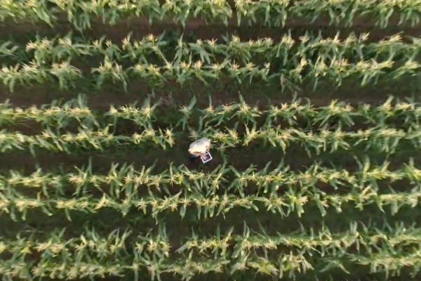
Ad Bastiaansen presented his work ‘Eco-system boosts digital Farming to feed the world’ in a segment of the conference themed “GeoAgri-Navigating the change” which aimed to explore new frontiers of smart agriculture. The emphasis of these series of talks was the value of ICT (Information and Communication Technologies) and geospatial technology in enhanced decision-making, effectively managing resources and assets, enhancing the efficiency of workflows, and improving the accessibility of information.
Bastiaansen evaluated the GWF conference as a significant event for WWC because one of its own aims, food security, was discussed in front of a much broader audience and it showed that information technology can play a crucial role in this endeavor. Ten years ago most people thought that food security only concerned farmers, the sellers of seeds and chemicals, but they were not familiar with information technology. Now, we see that the role of chemicals is declining while geographic information is becoming increasingly important. We now have the possibility to access information via satellite data and many other sources on a specific location, and then use this to create a wide variety of applications that empower the people who live there and related stakeholders.
In this world of information technology, doing the right thing at the right moment contributes to food security. And that is what we offer as Waterwatch Cooperative.
“At the conference, you notice an increasing number of applications related to information technology in agriculture and increasing awareness of digital/ precision farming supported by information technology. It will become a crucial part of our lives in the future in the next 20 years.”
The GWF also served as a platform where geospatial technology players forged closer ties with their stakeholders and could find new ideas, partners and potential customers, as well as a source for the latest updates in the field.